
Parts of Delhi under red alert as IMD forecasts heavy rain, thunderstorms till 2.10 pm

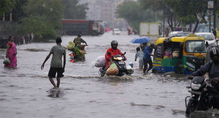
Parts of Delhi are under a red warning till at least 2.10 pm on Monday as heavy rain, thunderstorms, lightning and gusty winds are likely, according to the India Meteorological Department’s (IMD) district-wise nowcast warnings. The warning is valid until 2.10 pm, with the IMD forecasting heavy rain of more than 15mm per hour in the affected areas.
The IMD’s district-wise nowcast map, issued at 11.10 am, shows East Delhi under a red warning for heavy rain of more than 15mm per hour, along with thunderstorms and lightning. Winds of 30-40 km/h are also likely in the affected area. The warning is valid until 2.10 pm.
The map shows several other parts of Delhi under the red warning category, while adjoining areas are under an orange alert. The red-warning areas include large parts of eastern and southern Delhi, while orange-alert areas cover parts of western and central Delhi. The IMD has also warned of thunderstorms and lightning accompanying the rain in the affected areas.
Meanwhile, Uttar Pradesh’s Ghaziabad was under a yellow alert, the IMD placed Noida as well as Haryana’s Gurugram and Faridabad under an orange warning till at least 2 pm on Monday, according to the nowcast seen at 12:33 pm on the weather department’s official website.
The capital is likely to receive multiple spells of rain on Monday. However, the weather is expected to turn largely dry from Tuesday, with the IMD forecasting little or no rain for most of the rest of the week.
For Tuesday, the IMD has predicted only the “possibility of” very light rain during the afternoon. On Wednesday, a spell of very light to light rain is expected at a few places before noon. From afternoon to evening, another spell of very light to light rain is likely at many places, while moderate rain is expected at isolated places.
From Thursday to Sunday, the IMD has stated that no rain is expected, with partly cloudy skies likely to persist.
The IMD categorises rainfall up to 15.5mm as light, between 15.6mm and 64.4mm as moderate, between 64.5mm and 115.5mm as heavy, and between 115.6mm and 204.4mm as very heavy.
Why Delhi may see a dry spell
Experts said the changing rainfall pattern is linked to the monsoon axis not remaining over Delhi.
“It is still fluctuating, and is mainly remaining at the Himalaya foothills. It travels slightly southwards during the night, and thus we saw some rain during the nights on the weekend. However, from Tuesday onwards, the city’s weather is likely to be completely dry, as the axis will move completely to the foothills. Due to this, we are expecting dry weather to remain till the end of August, and even during early September,” said amateur meteorologist Navdeep Dahiya.
Private weather forecaster Ashwary Tiwari also warned of intense but scattered spells in parts of Delhi and the neighbouring areas.
“Scattered heavy rains with loud lightning strikes, gusty winds up to 25km/h will occur in parts of Ghaziabad, East Delhi, Noida, Gurgaon, Delhi, South Delhi, and nearby areas during next two hours. The weather will remain humid and hot after the spell ends, and there is a probability of more such scattered events in upcoming 2 days,” Tiwari posted on X at 10:55 am.
Delhi rainfall crosses August average
On Monday, Safdarjung, the IMD station considered representative of Delhi’s weather, recorded 3mm of rain. Delhi’s monthly rainfall is calculated by adding the daily rain received at Safdarjung on all days of the month.
With Monday’s rain, the total rainfall recorded in Delhi so far this month stands at 246.3mm, around 13mm higher than the IMD’s long-period average (LPA) rainfall of 233.1mm for August.
Last year, Delhi recorded a significant rain surplus, with 400.81mm of precipitation between August 1 and 31. The city had crossed its August LPA on August 15, after 11 days of rain.
Comments are closed.